

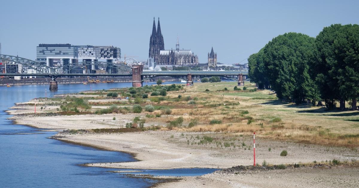
A prolonged, poor rainfall combined with recurrent and severe heatwaves, is worsening drought conditions across Europe. Following alarming signals in May, drought has further deteriorated in July and August, pushing Europe’s four major rivers – Loire, Po, Rhine and the Danube – to record low levels in August, according to Copernicus, the EU’s Earth observation programme.
A sequence of extreme heatwaves – fed by global warming – has had a compounding effect on drought in Europe. The drought has built up since early spring due to lower rainfall and higher than average temperatures, turning into fuel for the devastating wildfires in France and Spain in July. Forecasts point to more warm weather throughout August and into September. Moreover, the climate phenomenon El Niño may bring warmer-than-normal conditions, with warmth building towards spring 2027.
Water resources, crops, energy system, river transport, tourism and ecosystems area are all under growing pressure. At the same time, wildfire activity has increased across the continent, with the burnt area in the EU by 5 August 2026 ahead of the same period in 2025. Last year was the worst on record in terms of burnt area (1,034,552 hectares) in the EU, according to the Copernicus European Forest Fires Information System (EFFIS), operated by the JRC.
The latest data from the JRC run Copernicus European Drought Observatory (EDO) – updated on 10 August and referring to 21-31 July – show warning and alert-level drought conditions across most of the continent, with hotspots in France, Germany, Hungary, Romania, and the UK.
According to EDO, half (50%) of the EU and the UK is under drought at some level of intensity (watch, warning and alert) with 9% of the territory at alert level in July. “Watch” level indicates rainfall below usual levels, “warning” points to a drop in soil moisture, while “alert” means both conditions persist and vegetation is showing visible stress, signaling that drought is affecting crops.
In the same period in 2018 and 2022 – two exceptional drought years in Europe – 54% and 60% of the EU plus the UK territories respectively suffered drought conditions. Areas under alert condition this year are slightly lower than the extent of areas in 2022 which covered 11% of EU and UK territory, and are well above 2018’s 3%.
In 2022, drought reached its peak in mid-August, with 18% of the same territory in alert conditions; in 2018 the figure was 6% at the end of August.
Poor rainfall depletes soils and rivers in July
Scarce precipitation remained the main driver of the drought, with severe and prolonged rainfall deficits observed across central Europe, the Alps, large areas in Italy and the UK, the south-western Iberian Peninsula, the Balkans and eastern Europe. The strongest shortfalls in precipitation were observed in southern Germany, the Alps, central France, and western Ukraine, according to EDO data.
Soil moisture was below normal across much of central and eastern Europe, while severe-to-extreme low-flow conditions affected catchments in central-eastern Europe, Norway, Finland, the Alps, northern Italy and major rivers in Germany and France.
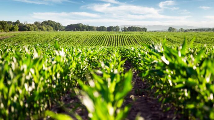
Vegetation indicators also show deteriorating conditions in parts of France, central Europe, Hungary and western Romania, where persistent heat and lack of rainfall increasingly constrained spring and summer crop development. According to the JRC MARS Bulletin published on 27 July, EU yield forecasts remain slightly above the five-year average overall, but below last year’s levels.
Compared with the previous month, winter crop forecasts, however, already declined by around 1–4%, while grain maize and sunflower estimated reductions of 6–7%.
Updated drought indicator data for Europe are available every ten days on the EDO European Drought Observatory page.
Heat affects health, water and energy systems
The broader consequences of the compound drought and heatwaves are becoming increasingly visible. Heatwaves have pushed temperatures to record levels in several European countries, while excess mortality has risen sharply during the most extreme episodes. With data being still collected, the World Health Organisation (WHO) reported on excess deaths of over 10 000, in just five countries, while Bloomberg compiled data puts the death toll at 25,000.
High temperatures and low river levels have also affected power generation, including reduced nuclear output in France. In Italy, the Po basin has faced severe hydrological stress. In Hungary and Romania, critically low river levels have disrupted Danube navigation, water supply and agricultural activity. Danube’s and Rhine’s critically low river levels have slashed hydropower and nuclear energy generation.
These developments underline how drought affects multiple sectors at the same time, including water management, agriculture and farming, transport, energy and public health.
Heat and drought push up the risk and severity of wildfires
Against hot and dry backdrop, wildfire activity has increased across Europe. According to EFFIS, up to 15 July the EU’s 2026 fire season remained below the 2025 season (the worst year on record) in terms of burnt area and number of fires, but already well above the long-term average.
In the following week, 2026 overtook 2025 for the same period, and by 5 August the total burnt area has reached 505,683 hectares since the start of the year compared to 379,392 hectares burnt by 5 August 2025. This places 2026 above both the long-term average and the 2025 season compared to the same period. Over the last month, large fires have been concentrated in southwest Europe, particularly in Spain and France.
The picture could still shift in the coming weeks. In 2025, the week of 5–19 August saw several large fires in Spain and Portugal, so the gap between the two years may narrow as this year’s data for the same period come in.
Although most fire events recorded in the first part of the year affected Mediterranean areas, significant events have also occurred beyond the traditional southern hotspots, including the UK, and northern France. This reflects a broader trend: wildfire risk is no longer confined to southern Europe but is increasingly affecting wider parts of the continent under prolonged hot and dry conditions.
Drought conditions, temperature and wind anomalies can have an impact on fire behaviour, and last June and July brought a sharp increase in burnt area across EU countries.
Wildfire data, including burnt area and fire counts by country, is available with weekly (or daily) updates through the page Current wildfire situation in Europe .
EU response, preparedness and prevention
To strengthen the management of wildfires in the EU, the Commission adopted in March 2026 a Communication on integrated wildfire risk management. The Communication covers the whole disaster risk management cycle – prevention, preparedness, response and recovery. It proposes measures that the Commission and member states could take to strengthen wildfire risk governance, land and landscape management, research and innovation, operations for response, population awareness and preparedness, as well as recovery.
In June 2026, the Council adopted a recommendation on integrated wildfire risk management, setting out a comprehensive framework to help member states better prevent, prepare for, respond to and recover from wildfires.
To prepare for the 2026 wildfire season, the EU put a dedicated rescEU fleet and teams on standby so they can move quickly where needed most. The 2026 rescEU fleet and the European Civil Protection Pool include 22 firefighting airplanes — 14 amphibious airplanes and 8 light aircraft — as well as 5 helicopters stationed across 12 countries. In addition, 15 ground firefighting teams, 5 ground firefighting teams with vehicles and 1 advisory and assessment team are available to intervene across Europe.
The Emergency Response Coordination Centre works around the clock and remains in constant contact with national civil protection authorities during the fire season. Any country affected by wildfires – within or outside the EU – can request firefighting assistance through the EU civil protection mechanism (UCPM). The 2026 wildfire season remains highly demanding, with seven UCPM activations in Europe since the beginning of the year.
Experts at Copernicus, EU’s Earth observation programme and its JRC-run Emergency Management Service (CEMS) complement this response by providing emergency mapping and geospatial information to support operations on the ground. Beyond drought and wildfire monitoring, the Copernicus Emergency Management Service delivers rapid on-demand mapping of specific affected areas, damaged assets and event evolution when activated by authorised users.
Since the beginning of June, it has supported authorities responding to wildfire events through 30 activations in Portugal, Greece, Spain, France, the United Kingdom, Germany, Croatia, Tunisia, Serbia, Albania and Greenland. Five of these activations are still ongoing.
Warmer and drier conditions forecasted into September
Seasonal forecasts point to continued pressure in the months ahead. An ensemble of eight forecasting systems contributing to the Copernicus Climate Change Service indicates much drier-than-average conditions across large parts of Europe from July to September, especially in central-western Europe and southern Scandinavia. Wetter-than-usual conditions are, however, expected in the Mediterranean areas.
For August, the outlook points to a continued risk of heatwaves affecting much of Europe.
River-flow forecasts from the Copernicus European Flood Awareness System (EFAS), implemented by the JRC, indicate low to extremely low discharges levels in August across many catchments in France, the Alpine region and eastern Europe.
Background
Experts behind the Copernicus European and Global Drought Observatories provide a series of analytical assessments on droughts, combining multiple indicators to detect, monitor and anticipate droughts and heatwaves. Together with the Copernicus European Forest Fire Information System (EFFIS), which monitors wildfire danger and fire impacts across Europe, they provide a comprehensive picture of how extreme weather conditions evolve and affect different sectors. Both systems are components of the Copernicus Emergency Management Service (CEMS), implemented by the JRC.
Beyond monitoring and early warning, CEMS also supports emergency response through its On-Demand Mapping component. Activated by authorised users during disasters and crises, CEMS delivers geospatial information on affected areas, damaged assets and event evolution, helping authorities to assess impacts and support operational decision-making.
Timely information on precipitation, soil moisture, vegetation and river flows helps authorities prepare for and respond to drought impacts. It also supports the objectives of the European Water Resilience Strategy. The Strategy aims to restore and protect the water cycle, improve water efficiency and secure clean and affordable water.
Related content
Current drought situation in Europe
European Forest Fire Information System (EFFIS)
Copernicus Emergency Management Service
European and Global Drought Observatories
European Water Resilience Strategy
Communication on integrated wildfire risk management
Council Recommendation on integrated wildfire risk management